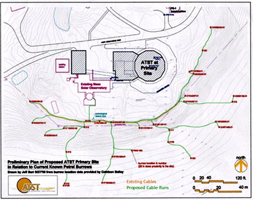
The Advanced Technology Solar Telescope (ATST) project is proposed for construction at one of two sites within the Haleakala High Altitude Observatories (HO). When Haleakala National Park (HNP) resource personnel and U.S. Fish and Wildlife Service (USF&WS) biologists identified concerns that construction activity may adversely affect nesting ‘ua‘u KCE began developing a monitoring system to evaluate the effects that ATST construction activity may have upon ‘ua‘u activity, nesting ‘ua‘u, and fledging success.
The monitoring system consists of a network of concealed day/night cameras, digital video recorders, and Internet connectivity to visually keep track of bird activities during nesting seasons before and during the proposed construction. The monitoring system must be reliable, effective, and most importantly unobtrusive. Installation was carefully designed to avoid being detected by the endangered petrels as they leave and return to their burrows.
KCE designed and built a remote electronic monitoring system for the injection well field at Tesoro Petroleum Corporation’s Maui terminal. Our system of sealed transducer type pressure sensors combined with dial-up remote reporting and archival capability has been operating successfully at the terminal for four years and is expected to operate reliably for many more.
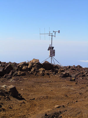
KC Environmental, Inc. operated and maintained the Comprehensive Atmospheric Prediction System (CAPS) for the U.S. Air Force Research Laboratory Maui Space Surveillance Site, under contract to the University of Hawai‘i Research Corporation. Designed and built by KCE, CAPS consisted of ten remote monitoring stations situated in various locations around the upper elevations and summit of Haleakala, Maui, with a central processor at the Air Force Advanced Electro-Optical System facility on Haleakala. Moment by moment changes in humidity, winds, temperature and solar flux were reported via RF link to the processor, which utilized a knowledge-based algorithm designed by KCE to predict short-temporal changes in weather that would arrive at the summit within an hour.
This information was shared with the University of Hawai‘i, National Park Service, helicopter tour companies, etc., to help those agencies and companies make decisions about telescope operations, flights, tours, work parties, and other activities that were impacted by sudden, inclement weather.